Re-inventing the Wilderness: Part 2 - Paths
In this blog series, I will dissect the spatial elements of wilderness environments and explore how tabletop-friendly prep and mechanics could be leveraged to revise exploration procedures. If you’re looking to start from the beginning, you can find Part 1 here.
“It is good to have an end to journey towards, but it is the journey that matters in the end.”
Ursula K. Le Guin, The Left Hand of Darkness (1969)
Travel is inherently defined by the paths we choose to take. These paths represent the primary decision points during travel, and our recollections of journeys often revolve around the routes we followed, shaping the rhythm and memorable moments of the adventure.
Paths have been a part of RPGs for a long time. In the first post of this series, I talked about how they’re used in traditional hex-based gameplay and are essential in pointcrawl adventure design. But they’re also important dungeon design tools. The deliberating corridor junctions, hidden passageways, unusual shortcuts, and looping routes all contribute to engaging play. These spatial techniques result in a celebration of space, despite their surface-level restrictions. In other words, a dungeon is engaging, precisely because you can’t go everywhere. The dynamic interplay between information, choice, risk, and reward all contributes to a captivating gaming experience, one that is seldom replicated in the wilderness.
A toolkit for paths
Just as dungeons hide secret doors, the wilderness should conceal secret paths. Just as a room might present an obstacle that requires you to backtrack or overcome a challenge, the wilds should offer similar hurdles. And the captivating twists and turns of dungeon corridors—our world’s routes should provide equally engaging choices and experiences as they crisscross and intersect.
Accessibility
How can this path be reached? Path accessibility can be understood and implemented in various ways, but the primary methods I’ve employed are:
- Awareness: Knowledge of the path grants access. For instance, players may be informed that heading directly south from the town’s east gate will lead them to the dryad’s grove. Think of this as akin to discovering a secret passage in a dungeon. It can be unveiled through rumors, gaining favor with local factions, thorough environmental investigation, or clear signposts. Once they are aware of the path, utilizing this information (and potentially sharing it) offers a recurring reward—either a shortcut or the value of reaching the destination itself. Additionally, I’ll delve into elevation later, but just as discovering secret doors is a reward for meticulous mapping, uncovering hidden locations and their associated paths is a reward for observant exploration during elevation.
- Puzzle: Progressing along the path requires either a specific item or an intricate interaction. For example, a rope bridge is designed to split in the middle once the majority of the weight has crossed the midpoint. Consider this akin to the puzzles and traps found in dungeons. It’s crucial that the presence of the path and the puzzle are apparent, while the solution remains elusive. In fact, similar to most dungeon puzzles, the optimal solution is not dictated but uncovered through creative thinking and experimentation.
Challenges
What are the risks associated with this path? Some paths come with inherent dangers that threaten our characters and their equipment. From my experience, the most impactful ways to introduce this element are through challenge-based procedures or altering encounter probabilities.
- Procedure: Safe passage depends on engaging in a distinct minigame. For instance, crossing the treacherous weeping cliffs might require successfully navigating a skill challenge (linked to the Veins of the Earth procedure). This approach is most suitable for physical challenges en route to remote locations (or as significant shortcuts): swimming, climbing, spelunking, stealth, sledding, canoeing, and so forth. These challenges need not be solely physical; they can seamlessly integrate with more fantastical paths. For example, a fairy road might demand a combination of skills inspired by Errant’s lockpicking to traverse safely (bonus point: the clues for this combination exist within local nursery rhymes).
- Encounters: The path may present a higher likelihood of encountering danger or more perilous encounters. Consider, for instance, that the road passing through the abandoned dwarven mine requires rolling for encounters three times as frequently. While this concept can be applied to an entire region (which we’ll discuss in a future post), it works particularly well for distinctive and significant routes leading to untamed and deserted locales. How your encounters are affected depends on your encounter system and might even introduce unique encounters (e.g., the regional roll-table is modified, where a result of 4-6 on 1d6 always yields the appearance of the Ghost of Adelaide Trist). Alternatively, you can guarantee a specific encounter on the route (e.g., this trail crosses a bridge guarded by a Troll named Nurak, demanding a toll or a battle).
Connections
How do paths interconnect and progress? The arrangement of paths, their interconnectedness, and the points at which they converge or diverge significantly influence the pacing of overland exploration. A well-crafted wilderness setting would be punctuated with engaging choices at meaningful spots, compared to the broad options in hexcrawl navigation. Below are techniques for designing path layouts that make path exploration intriguing:
- Loops: Offer non-linear routes that present compelling choices. For instance, adventurers may opt to follow the trade road to the next town or take the longer path through the mountain range. It’s crucial that the distinctions between these route options are evident, and the choice isn’t straightforward. Using the same example, the mountain trail should provide advantages (such as resources, elevation, secrecy, valuable sites, etc.) that outweigh the convenience and efficiency of the trade road.
- Dead-ends: Linear paths leading to significant, isolated locations. For example, the sole lightbridge found at the Spineridge mountain pass leads to the remote Rosteq Monastery. Unlike loops, these paths are linear and necessitate backtracking, making them natural focal points, especially if revisited. Use them sparingly and thoughtfully. If one of these linear paths becomes frequently travelled, consider altering it according to factors like weather, season, or recent events.
- Elevation: Incorporate a Z-axis to enhance the spatial understanding of the landscape. For instance, as you ascend the Spineridge mountains, you can clearly spot the town of Akaton in the Rust Forest below, along with a clearing north of it. While elevation’s significance will become more apparent later (when we delve into Points of Interest and Landmarks), it’s essential to recognize its value on a route, primarily for the perspective it provides. I’ll provide a summary of elevation bands here, but it warrants its own dedicated post: 0 (lowlands/foothills), 1 (montane), 2 (subalpine), 3 (alpine), 4 (summit). If you’re at a higher elevation, you can perceive hints of lower elevation paths and points of interest, whereas from a lower elevation, you can only discern significant landmarks (like the Rosteq Monastery against the backdrop of the Spineridge mountain range). Each Point of Interest above the foothill elevation is assigned a number denoting its height on the map, facilitating the GM’s description of visibility during an ascent.
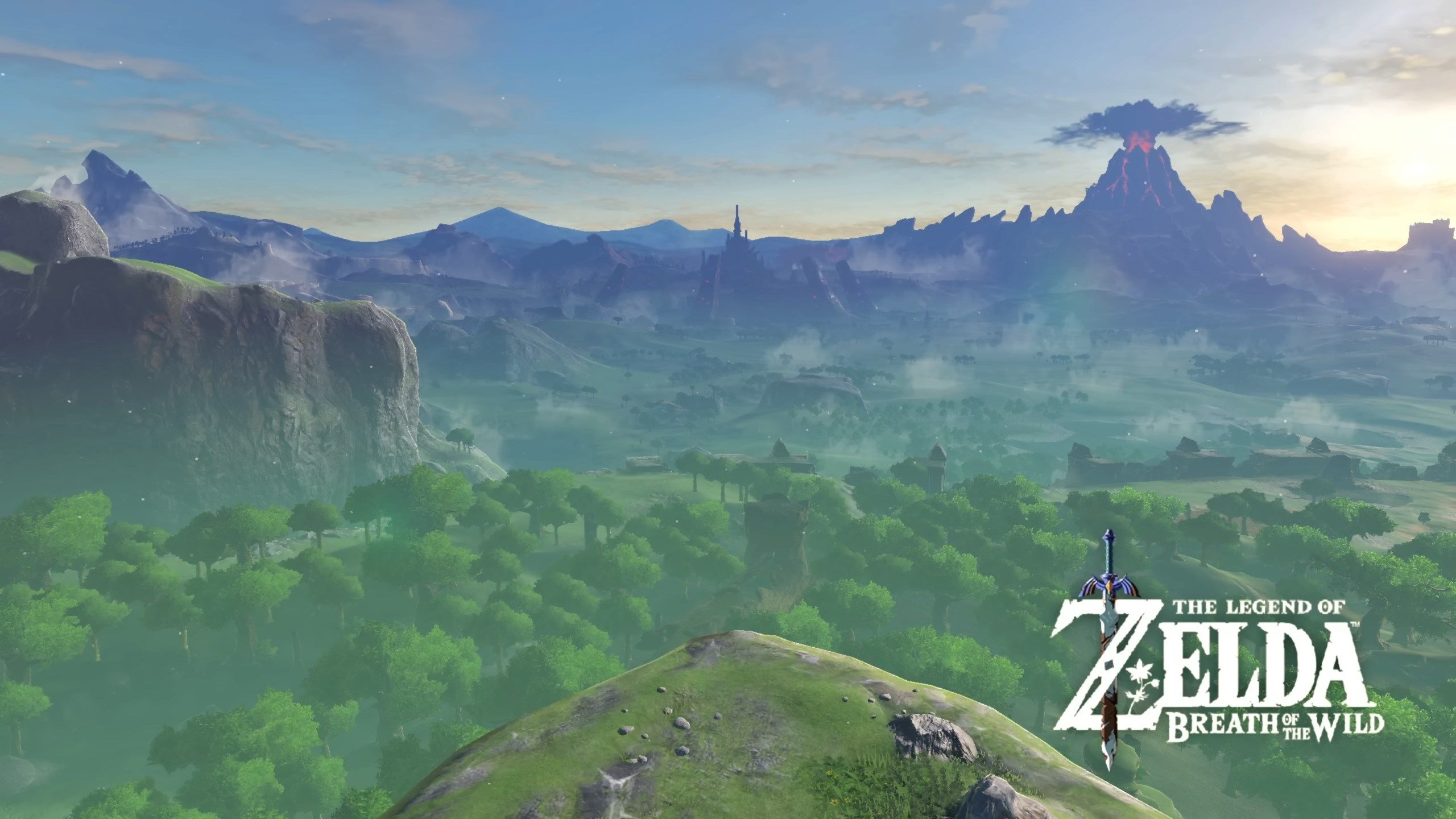 Open world video games like Breath of the Wild use elevation expertly to present and obstruct spatial information.
- Chains: Define the rhythm and density of a route. For example, the Spineridge mountain pass might consist of three segments/stretches (ascent, ridge-line, and descent). This segmentation slow down gameplay and provide a more immersive experience in traversing the world. My preference is to simplify the chains for trade routes significantly, making them efficient and safe for fast travel, with fewer notable features. Just as you don’t use dungeon-crawling procedures while navigating a local town, wilderness exploration along trade roads should similarly be more streamlined. If it helps, consider in the real world how streamlined your commute or journey into town is compared to exploring a local forest path for the first time.
Duration
How much time is required to traverse a path? If you’re a GM accustomed to tracking dungeon turns by meters, you might find this system less appealing. However, I prefer to measure dungeon turns on a “per room” basis, and similarly, I gauge wilderness turns based on a “per path” basis (per segment/stretch, not a complete chain). The specific duration may vary depending on the focus of wilderness exploration in your game, whether it’s a 4-hour watch, half a day, or a full day.
Surroundings
What is the environment like around this path? This aspect is typically determined by the adjacent Points of Interest and the overall region, which is why I rarely prepare specific environmental details in advance. However, just as dungeon architecture provides insights into an adventure site, paths can offer clues about the destination, potential encounters, and regional events. For instance, the road leading up the Spineridge mountain is adorned with pilgrimage shrines. It’s important to note that these details complement any random encounters and player investigations. When paths are consistently marked with such details, it reinforces to the players that they are indeed on the same path.
A path is a path is a path is a path
I want to emphasize that a path is not always a conventional road. Especially in untamed wilderness, paths can take on diverse forms. In some instances, they might be formed by navigational instruction (for example, “once you reach the Lightning-struck tree on the Queen’s Road, head south to find Fog Lake”).
Roads are typically well-marked, maintained, and efficient. Common trails may be less maintained or secure but still reasonably obvious. A path could also follow a natural pattern in the environment, such as an animal trail, a watercourse, the coastline, a mountain ridge, or heritage markings.
There are numerous possibilities, and I encourage you to let your creativity flow when designing your region.
Encouraging path exploration
Paths play a crucial role in the context of Points of Interest (the next blog post will be solely dedicated to this aspect). Ultimately, players are motivated by their interests, whether those are driven by character goals or mechanical incentives. While they may not have a complete understanding of what their journey will entail or how it will test them, there should always be a clear reason for embarking on it. Players will willingly embark on challenging journeys when they are provided with information (such as distinct landmarks, local rumours, quest hooks, etc.) that beckons them into your world.
Annotating paths
The conclusion of this series will provide a comprehensive overview of my procedures for preparing and documenting these details. However, I’d like to offer some insight into my ongoing progress in each instalment. Here’s how I currently annotate mechanically relevant path details:
 Path key
What’s to come…
In the next post, we will delve into Points of Interest (POIs) and their role in propelling player exploration, as well as explore the most engaging methods for conveying them to players. Read part 3 “Points of Interest” now!
Further reading
https://hillcantons.blogspot.com/2012/01/crawling-without-hexes-pointcrawl.html
https://thealexandrian.net/wordpress/48666/roleplaying-games/pointcrawls
https://iuliu-cosmin-oniscu.medium.com/guidance-and-orientation-in-open-world-maps-c7ff78a12a05
https://www.gamesindustry.biz/how-to-create-engaging-open-worlds